Local Climate Zones
Local Climate Zones (LCZ) is a particular land-use classification framework to describes urban surfaces structure and cover with consistency and comparability across cities, supporting applications in studies of urban heat waves, sustainable urbanization and urban energy balance [2]. The LCZ classification scheme [3] and instructions are accessible through the World Urban Database and Access Portal Tools (WUDAPT) project web portal.
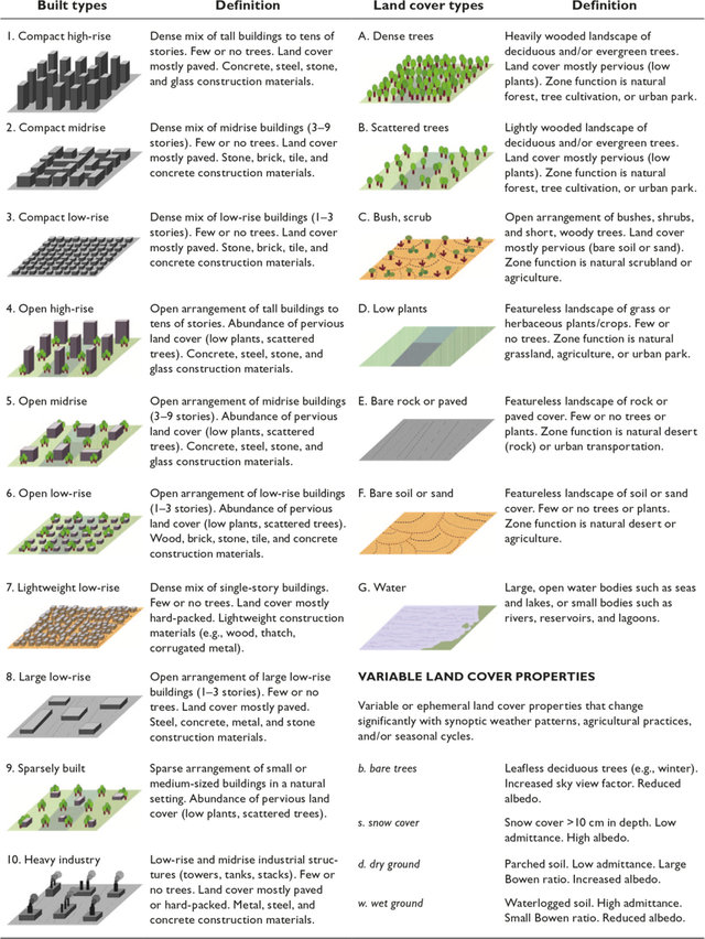
Local Climate Zone scheme
Note
In the hands-on exercise, you will use an already available LCZ map of Milan. The analytical procedure to derive LCZ maps from optical satellite imagery is out of scope for this tutorial.
| [2] | Stewart, I. D., & Oke, T. R. (2012). Local climate zones for urban temperature studies. Bulletin of the American Meteorological Society, 93(12), 1879-1900. |
| [3] | Bechtel, B., Alexander, P. J., Böhner, J., Ching, J., Conrad, O., Feddema, J., … & Stewart, I. (2015). Mapping local climate zones for a worldwide database of the form and function of cities. ISPRS International Journal of Geo-Information, 4(1), 199-219. |